
FGD Mitigasi Bencana Kota Ternate
The Focus Group Discussion was held on Thursday, September 30, 2021 in the Meeting Room of the Ternate City Regional Disaster Management Agency office which is a collaboration between the Faculty of Geography, Gadja Mada University and BPBD Ternate City. The FGD was themed Development of Disaster Management Methods and Procedures in Small Islands – Integration of Sister Island Concept and Remote Sensing Data Processing.
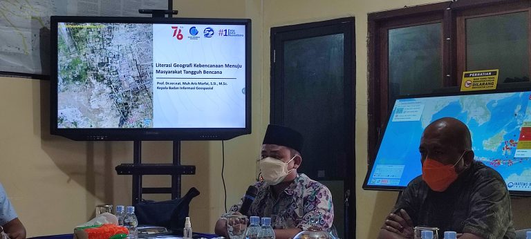
Participants who attended this FGD activity included representatives from BPBD North Maluku Province, BPBD Ternate City, BPBD Tidore Islands City, Forum PRB Ternate City, Center for Disaster Studies Khairun University, Bapelitbangda Ternate City. Meanwhile, UGM was represented by lecturers from the Faculty of Geography, and was present on this occasion the Head of the Information and Geospatial Agency (BIG), Prof. Dr. Muh. Aris Marfai M.Sc.
In his presentation, the Head of BIG said that the importance of remote sensing data needs in disaster mitigation, especially in remote areas that are difficult to reach such as those faced by North Maluku province. Information data has now become an asset of the nation that needs to be continuously developed. Spaced data can already be obtained on the official BIG website, although there are still some that have not been fulfilled. In addition, on this occasion, the Chief Executive of BPBD Ternate City, represented by the Head of Planning, also discussed the condition of disasters in Ternate City that often occur including floods, earthquakes, landslides, volcanoes and potential tsunamis.